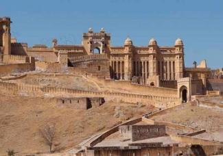
From the 16th century to the 18th century, the Mughal empire covered much of South Asia. Of central Asian descent, Mughal rulers “saw themselves as inheritors of the legacy of Mongols and Timur, world conquerors and successful rulers,” says Ramya Sreenivasan, associate professor of history in the School of Arts & Sciences. This summer, Sreenivasan worked with four undergraduates as part of the Penn Undergraduate Research Mentoring Program (PURM) to get behind the façade of the imperial state, using GIS deep mapping to ascertain how the empire was formed and maintained militarily.
Read the story at https://penntoday.upenn.edu/news/mapping-mughal-empire
